Pays Rhin Vignoble Grand Ballon
  • Français
  • Deutsch
  • English

Hiking route: Tour of Murbach Small Valley

Durée moyenne Half-dayDistance à parcourir 14 KmDénivelé positif 670 m Experienced

Description

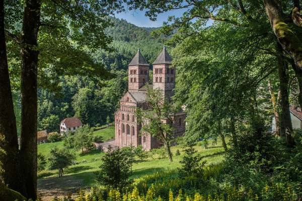
This itinerary is for experienced hikers in good physical condition. Discover the small valley of Murbach and its famous abbey which held political, spiritual and cultural influence for a thousand years over a large territory. Along the way, you can enjoy many views of the abbey and the small valley of Murbach as well as tables and benches for a rest or picnic.

Duration: 4h
Length: 14 km
Accumulated altitude: 370 m + 300 m
Hiking sheet and topographic guide are available from the Guebwiller and Soultz Tourist Offices.

Additional Information

Latitude 47.923041988241
Longitude 7.1607022433811
Type de balisage
Altitude 440 m



Nearby

  • Murbach

    Murbach Abbey

    At the foot of the Grand Ballon, the Abbey Church of Murbach awaits you by the side of a shady road. The Monastery was one of the most powerful in the...

  • Guebwiller

    Hiking map: 3620 ET, Grand Ballon, Guebwiller, Cernay

    Topographic map with top 25 hiking routes and tourist information. 3620OT, IGN, Hiking map: Grand Ballon, Guebwiller, Cernay, PNR of Ballons des Vosg...

  • Guebwiller

    Hopplà' Pass: the intelligent chequebook

    "Composed of 19 cheques, this intelligent chequebook allows visitors to enjoy more than €200 of benefits. Access is therefore free in six tourist si...

  • Guebwiller

    Hiking map: Grand Ballon Petit Ballon Markstein Vieil Armand

    Topographic map with top 25 hiking routes and tourist information, IGN Hiking Map, Grand Ballon Petit Ballon Markstein Vieil Armand. 1:25,000 / 1 cm ...

  • Guebwiller

    Topographic hiking guide "paths of fortified castles"

    Discover the remnants of old fortified castles of Florival Region through 5 walking tours. Detailed descriptions and maps. Community of Municipalities...

    Partager votre expérience

    comments powered by Disqus